Pierre FSS History, 1990

PIR FSS 1990.jpg (53714 bytes)

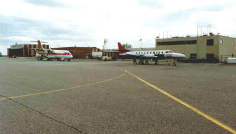
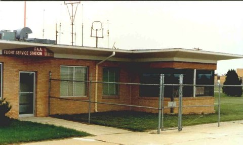
Pierre FSS (PIR), South Dakota, 1990

Aircraft Continental Express, ATR42 and Mesaba Metro on ramp at Pierre Regional Airport in 1990. FSS was located on the second floor of the terminal where a long row of narrow windows is visible. The air traffic managers office was on second floor to right (where the larger square window is located).

Historical Information
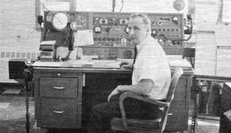
Pierre, South Dakota FSS (PIR) 1972
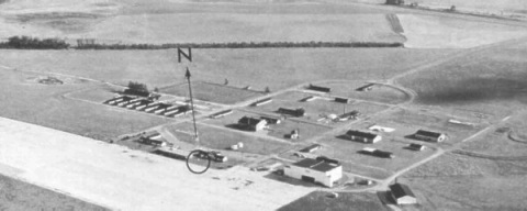
The Pierre FSS (PIR) was located on the second floor of the Pierre Municipal Airport terminal building.  Both, air traffic and airways facilities personnel occupied the quarters.  Pierre Municipal Airport is located four miles northeast of the City of Pierre, the capitol of South Dakota.  The airport had two runways, 13/31 and 7/25, both 150′ wide and 6900′ long, with a VOR Approach to 7 and 25.  North Central Airlines and Western Airlines served Pierre utilizing Douglas DC-9’s, Boeing 737’s and Convair 580’s.

In mid 1972, Pierre FSS was staffed with seven specialist, four who had less than three years experience.  They were Harold Bolyard, Roy Stanek, Pat O’Connor, Blaine Olson, Baxter Sowell, Wilbert “Will” Showers and Bill Parker (#3734). The Facility Chief was Jack Mitchell (#3736).  Pierre had a large flight service area, covering over 20,000 square miles, including 45 airports, four remote VOR’s, one radio beacon, one RCAG, direction finder (DF) and weather observations.  Pierre was well represented by FAA, hosting the FSS, Airways Facility Sector Office, Airways Facility Unit, and an Airports District Office.  The South Dakota Aeronautics Commission was also located in Pierre.  They operated a Beechcraft Twin Bonanza (BE50) and a Piper Navajo (PA31).

Historical information obtained from the FAA Rocky Mountain Intercom, dated 26 May 1972. Submitted by William “Bill” G. Parker #3734, Nov. 25, 2007.

Watertown WX Obs 1986-87

http://www.atchistory.org/wp-content/uploads/2017/11/SD_photos_ATY_JimAnez_Reading_Temps_1986-87.jpg (29866 bytes)

Watertown FSS (ATY), South Dakota, 1986-87

Watertown Weather Observation.  ATCS Jim Anez reading the outside temperature and dew point during the winter.

Huron FSS, 1984

Huron FSS (HON), South Dakota

The facility was decommissioned July 23, 2007.

HON LOOKING N 2-84.jpg (45596 bytes)

Huron FSS operations looking from south end towards the north. Inflight positions to left by the LABS terminal, TLSU and teletype bank to right.  EFAS and RRWDS midway on left, supervisor’s desk center of area at the far end. Quarters were shared with NWS and they were located at the north end of the building (beyond the wall map). ATM and secretary’s offices were located where the windows can be seen along the wall to the right.

______________

Straight on view of the Preflight positions at Huron FSS. RRWDS displays are at left, Leased Service A are at right.

______________

Photo taken along wall near the north end of operations. GS 200 system is in the foreground. Inflight and broadcast are located along the console at the center of the picture. Teletypes and TLSU are to the left.

______________

ATCS Arlene Bauder sits at teletype. Leased Service A printers at left end of bank. TLSU to her right. The training/conference room were located beyond the window at the right center of the photo.

Watertown FSS Inflight, 1968

http://www.atchistory.org/wp-content/uploads/2017/11/SD_photos_ATY_UnknownSpecialist_IF_1968.jpg (30090 bytes)

Watertown FSS (ATY), South Dakota, 1968

Watertown Inflight position.  Specialist unknown.  Note that the console is almost identical to the way it looked in the 1986 photo (and still looked when the facility was closed in August 1994). Photo is from a brochure prepared by the airport for an open house.

Watertown FSS Photos, 1986

Watertown FSS (ATY), South Dakota, 1986

The FSS building was located on the east end of the terminal building. The window of the ATM’s office is just visible on the far left edge of the photo.

______________

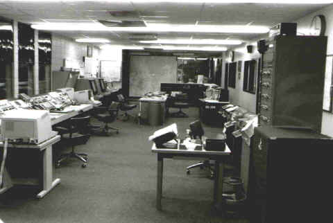
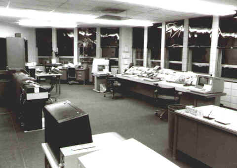
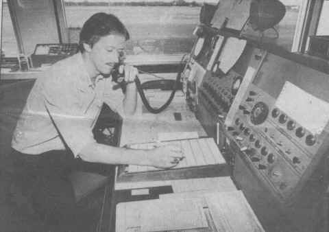
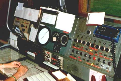
Watertown FSS Inflight console

______________

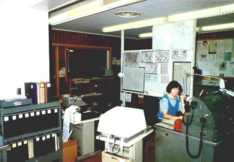
ATCS Leslie Moritz. View is from southeast corner of operations looking northwest

______________

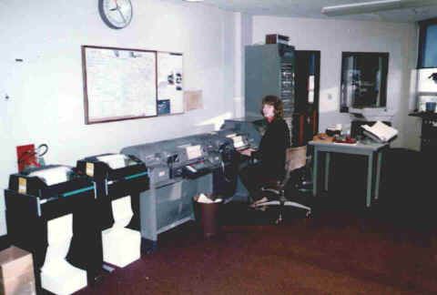
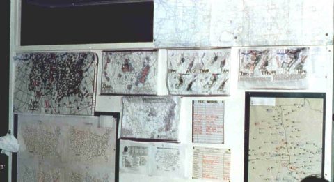
Preflight display of weather maps, AIRMETs, and NOTAMs

______________

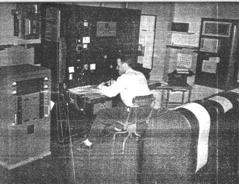
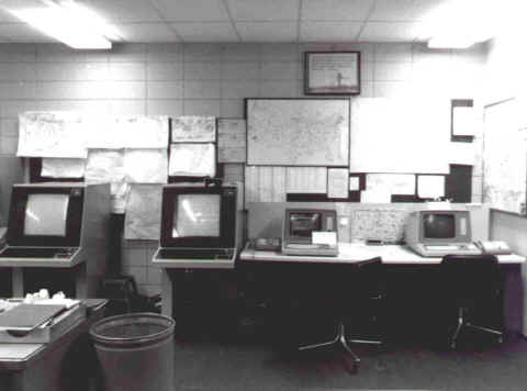
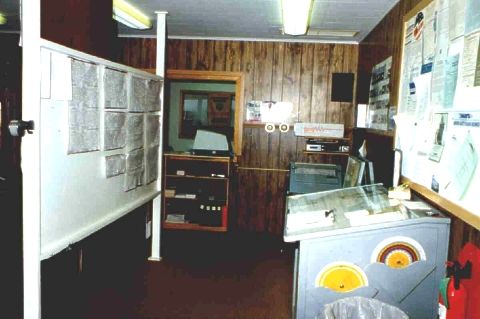
Watertown Weather Observation position showing the weather observation desk on the right  and Preflight map display on left

Anderson AFSS Employees, 2002


Submitted by Nathan Sewell

Anderson AFSS (AND), South Carolina 2002 

Left to right, Esther Lloyd (representing the FSS Academy), Nathan Sewell, and Ernie Wilson, during transition training to the new OASIS Automation computer system.  The facility was decommissioned July 16, 2007.

Aberdeen FSS, 1987

Aberdeen FSS (ABR), South Dakota.  1987

ATCS, Dave Sorensen, at the Inflight console, Aberdeen FSS, January 1987 (taken from a newspaper article about the planned closure of the facility)

Watertown Radio, 1950

http://www.atchistory.org/wp-content/uploads/2017/11/SD_photos_ATY_RADIO_About_1950.jpg (30205 bytes)

Watertown Radio (ATY), South Dakota, 1950

Ed Bauer on duty at Watertown Radio.  Photo is from a brochure prepared by the airport for an open house.

Watertown Airport, 1959

Watertown FSS (ATY), South Dakota, 1959

This photo is from the NWS Climatological report for Watertown. The FSS (and weather observation point) are in the circle at center. The airport was developed by the Army Air Corp during WWII as a bomber training base and later as a cold weather research station.